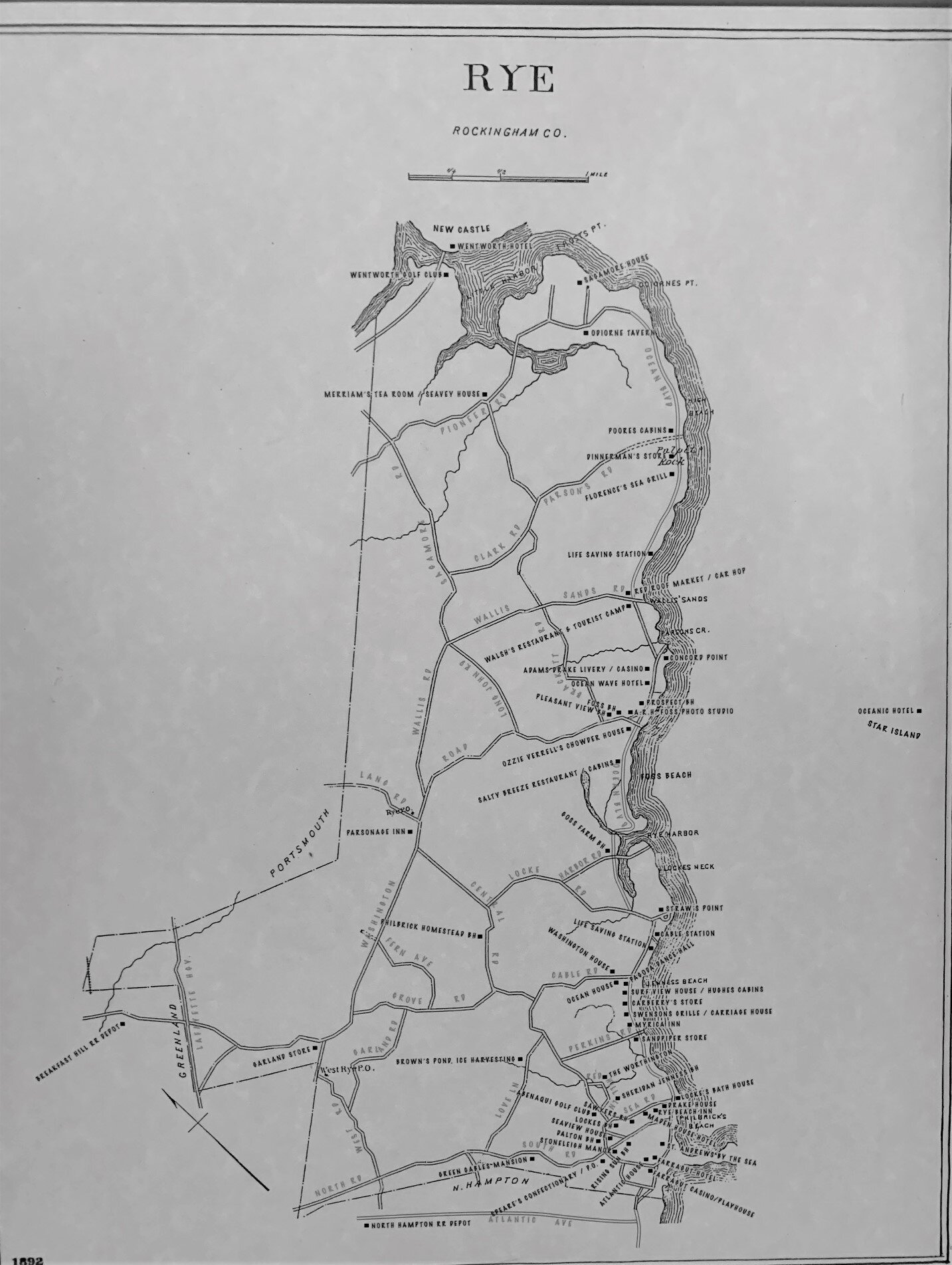
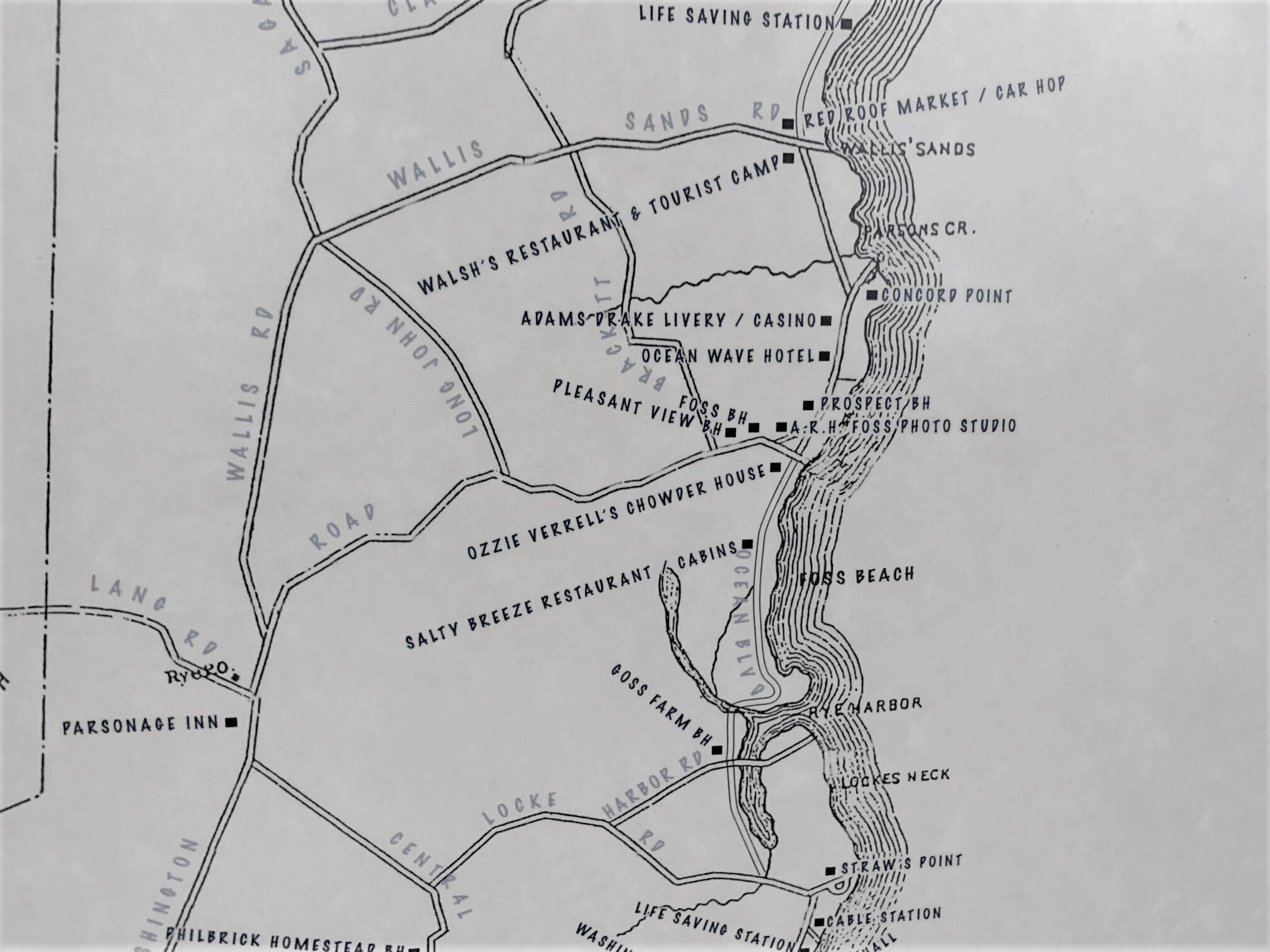
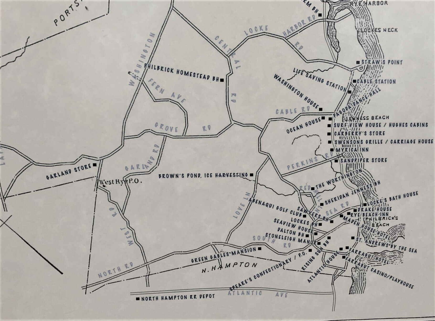
The Roads of Rye, NH
Two roads diverged in a wood, and I—
I took the one less traveled by,
And that has made all the difference.~Robert Frost
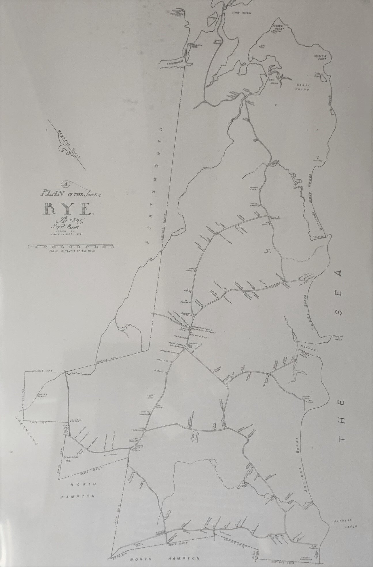
The modest spider web that is the first map of Rye, NH, drawn by Phineas Merrill of Stratham in 1805, tells many a tale of blazed trails, hunting patterns, early homesteads, and deliberate efforts to inhabit a place and make it connect. Geography is the mother of history. The pattern of Rye’s roads is no exception.
Natives were semi-nomadic along the coast and inland. Washington Road is one of their trails, and later the Jenness family widened the path into a road all the way from Breakfast Hill to the sea. Washington’s visit to Portsmouth in 1789 changed the name. When farmers began to work their grants, they made a rough path; when three or four grants were made together, the connected paths became a “public highway.” [Parsons, 81]
There was a path before 1644 from Frost’s Point along the creek over into Strawbery Banke. This avoided crossing Sagamore Creek. If there was no ferry across from Great Island (where there was ferry service from the 1640s), a person would have to go above the creek (Peverly Hill Road today) and then into Portsmouth. By 1644, there was a path along the shore from Strawbery Banke, by Great Island out by Rendezvous Point, and all along the six miles of Sandy Beach to Hampton.
Another path ran from Frost’s Point along what is now Pioneer Road and up Sagamore, through what would become the center of Rye, then on to North Hampton. In 1727, the path that led from the center southeast to the beach was finished as a wagon road that became Central Road.
Today you can walk from Rye center to Market Square in Portsmouth in about an hour.
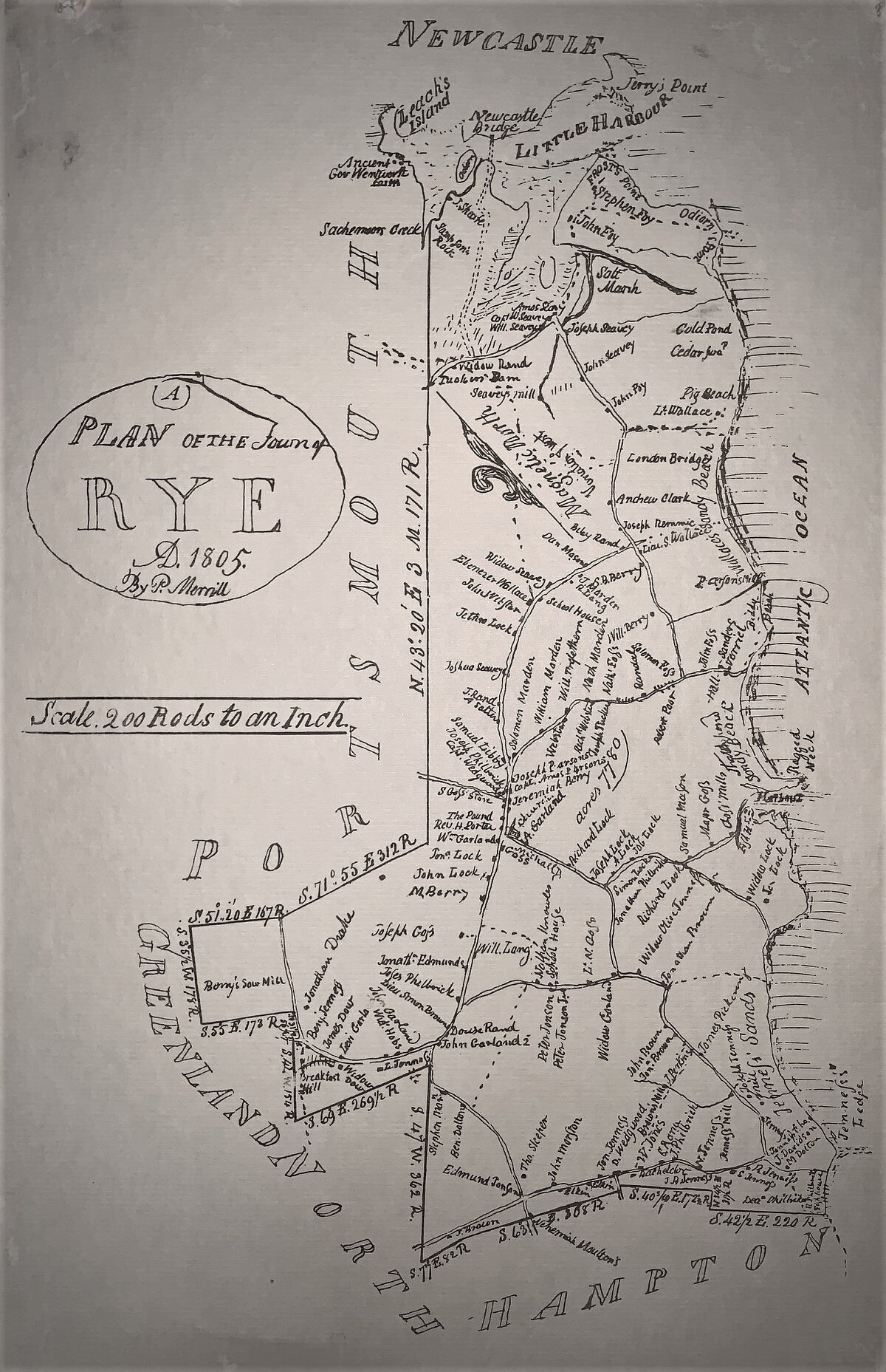
Phineas Merrill: Mapmaker
Courtesy of the Exeter Historical Society
On December 30, 1803, the State passed an act requiring all towns to create a map “containing the exact limits of the said towns by careful admeasurement, together with a description of all public roads passing through the same, also the rivers, falls and principal streams, ponds lakes and mountains, and the names of adjoining towns.”
The purpose of the act was to create a State map of New Hampshire. The town maps had to be complete by November 1, 1805. Failure to comply would incur a $150.00 fine.Phineas Merrill, who was born in 1767, was a self-taught surveyor. He served in many capacities in Stratham, including town selectman, school teacher and state legislator…His best-known skill, however, was as a map maker. When the 1803 Act was passed, Merrill became the obvious choice to assist Phillip Carrigain, the Secretary of State, with the immense task. Together they collected the maps that were submitted to the state and returned 130 of them to the towns because they weren’t deemed accurate enough. Historian Charles Bell, of Exeter, later wrote that “the surveys of some of the towns were made by incompetent persons, and it required ingenuity if not actual force to fit them perfectly together.” Of the hundreds of maps submitted, those made by Phineas Merrill were some of the most beautifully done. Merrill surveyed the towns of Barrington, Bartlett, Greenland, New Castle, Portsmouth, Rye, Stratham and…Exeter.

